
Sky-Guard Console
Digital Intelligent Flight Decision Support System
Console + EO System Demo
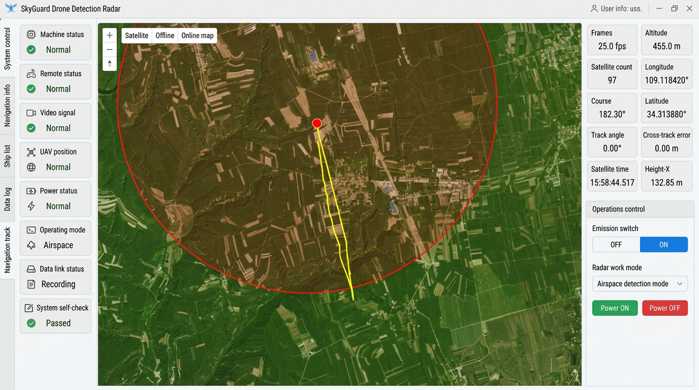
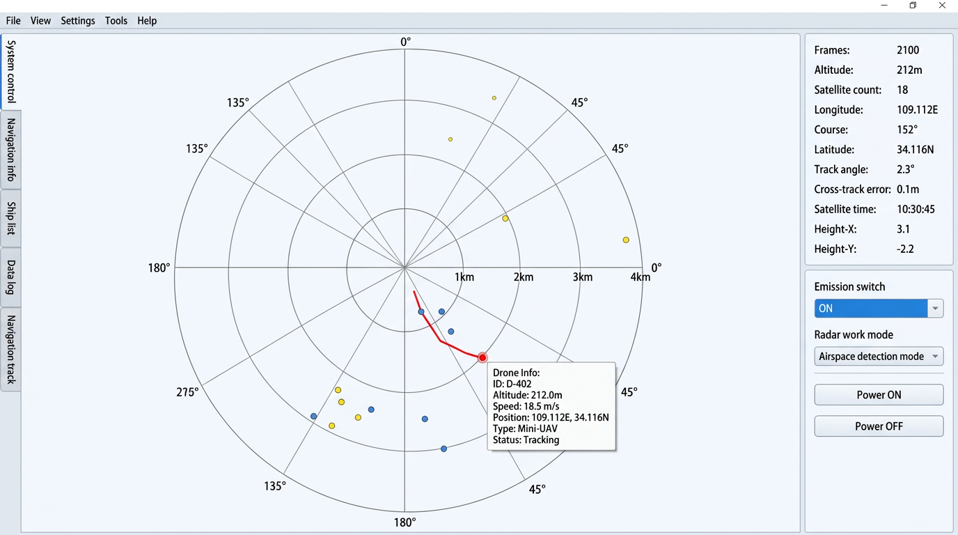
Live console view with EO target confirmation
This demo video shows the Sky-Guard console fusing map-based situational awareness, spectrum monitoring, target cueing, and EO visual confirmation in one operator workflow.
Full demo video · 8:06
Background
As the low-altitude economy accelerates and public interest in recreational aviation grows, flight camps — serving general aviation, paragliding, drone testing, powered hang-gliders, hot-air balloons, and other light aircraft — are transitioning from experience-based management to data-driven, intelligent operations. Weather conditions such as wind speed, temperature, humidity, barometric pressure, cloud ceiling, and precipitation have a decisive impact on the safety and performance of light aircraft. The Sky-Guard Console bridges the gap between raw meteorological data and actionable flight decisions.
Core Capabilities
- Real-Time Weather Assessment: Continuously evaluates whether current conditions meet safe takeoff and landing thresholds for each aircraft type.
- Flight Simulation: Models flight attitude, climb rate, glide ratio, and control difficulty under varying meteorological scenarios.
- Optimal Flight Planning: Recommends best takeoff/landing direction, timing, climb profiles, holding patterns, and return-to-home waypoints.
- Ideal Flight Window Prediction: Forecasts time-slot-based operating windows to optimise camp scheduling and customer booking.
- Automated Risk Alerts: Generates flight-risk warnings and operational recommendations to support instructors and pilots in real-time decision making.
- Personalised Flight Advice: Tailors recommendations based on site terrain, user profile (age, activity intensity), and spatiotemporal context.
Personalised Camp Features
- Individual flight decision recommendations per visitor
- 3-day advance safety risk forecast for the camp
- Optimal flight period suggestions
- Visual flight-path preview and simulation
- Locally-tuned AI decision model that improves over time
- Emergency / sudden-change weather alerts
Solution Architecture
The system fuses real-time meteorological data ingestion, an aircraft performance parameter library, aerodynamic models, and AI-assisted decision algorithms into a unified platform. Data sources include gridded weather model outputs (1–2 km resolution), on-site sensor calibration, and historical operational records.
Service Tiers
| Feature | Standard | Professional | Enterprise |
|---|---|---|---|
| Core Output | Index monitoring & review | Index-driven decision loop | Full custom pipeline |
| Forecast Horizon | 24 h rolling | 48 h rolling | 72–120 h trend |
| Monitored Points | 5 custom locations | 10 custom locations | 10+ (expandable) |
| AI Service | — | Multi-index analytics | Self-learning model |
| Alert Channel | Web dashboard | Real-time push notifications | Multi-channel + audit trail |
| Deliverables | Flight data logging, 24 h forecast, 5-point report, web portal | Daily report + video briefing, 48 h forecast, 10-point report, push notifications | Custom decision reports, flight behaviour logging, 72–120 h forecast, 10–15 point report, multi-system push |
Compliance & Risk Boundaries
- The service provides indices and advisory actions only; it does not replace any certified environmental data product.
- Indices serve as decision support, not the sole basis for safety or regulatory compliance. Operators must retain final authority and on-site verification procedures.
- When historical data is insufficient or significantly biased, model uncertainty will increase. The system flags such conditions and supports fallback to rule-based / conservative strategies.
Download Datasheet
Full A4 product datasheet in PDF format with system overview, service tiers, and compliance notes.